3rd Nov, 2015 12:00
Maritime and Scientific Models, Instruments & Art ('Encounter')
122
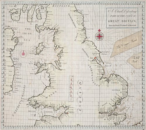
[M] 'A CHART DESCRIBING PART OF THE COAST OF...
possibly after John Sennex, on laid paper with lightly shaded coastline naming principal towns -- 21 x 23½in. (53 x 60cm.)
Sold for £99
Estimated at £100 - £150
(inc. buyer's premium of 24%)
Condition Report
Fine condition overall, this will have been removed from an atlas.
We are pleased to provide you with a general report of the condition of this property. Since we are not professional conservators or restorers, we urge you to consult with a restorer or conservator of your choice who will be better able to provide a detailed, professional report. Prospective buyers should inspect each lot to satisfy themselves as to condition and must understand that any statement made by Charles Miller Ltd is merely a subjective, qualified opinion. Prospective buyers should also refer to any Important Notices regarding this sale, which are printed in the Sale Catalogue. NOTWITHSTANDING THIS REPORT OR ANY DISCUSSIONS CONCERNING A LOT, ALL LOTS ARE OFFERED AND SOLD “AS IS” IN ACCORDANCE WITH THE CONDITIONS OF BUSINESS PRINTED IN THE SALE CATALOGUE.
possibly after John Sennex, on laid paper with lightly shaded coastline naming principal towns -- 21 x 23½in. (53 x 60cm.)
Auction: Maritime and Scientific Models, Instruments & Art ('Encounter'), 3rd Nov, 2015
