27th Apr, 2021 10:00
Maritime and Scientific Models, Instruments & Art (Untiring)


28
[Z] JOHN SELLER: 'PRACTICAL NAVIGATION', CIRCA 1683
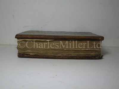
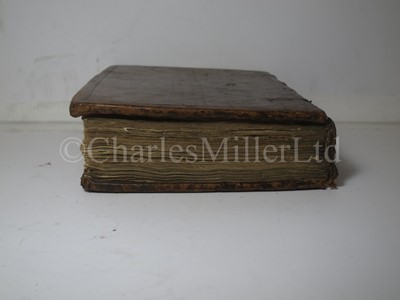
JOHN SELLER: 'PRACTICAL NAVIGATION', CIRCA 1683
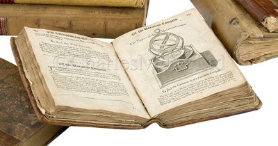
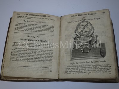
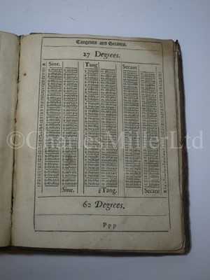
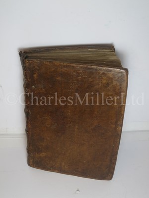
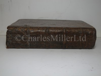
seven engraved illustrations in the text, five folding woodcut diagrams, four woodcut illustrations and numerous diagrams, lacks numerous leaves of text, contemporary blind-stamped calf, head of spine a little worn, 4to, [London, c1683]
Sold not subject to return
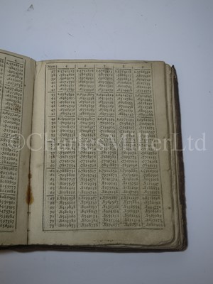
The tables of latitude and longitude (and vice versa) contain numerous place names in North and South America and the South Seas.
One of the first guides to use modern scientific and mathematical methods for sea navigation, with engravings illustrating the use of compass and sextant, and contemporary log tables bound in (as issued.) 5th edition, all editions being rare and usually distressed, no doubt because they were used at sea.
John Seller (1632-1697) was a London compass maker who went on to compile and publish maps, charts and navigation guides, appointed Hydrographer to the King in 1671.
Condition Report
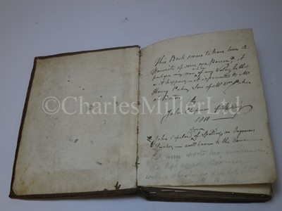
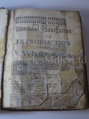
Lacks title, several leaves before ggl and TE4, Q4, al and all after 352, numerous clumsy repairs at beginning and end, a little browned and stained. With 18th century hand-drawn replacement title page, one of the folding plates and parts of a few early pages, and later repairs. Some pages misnumbered, at least 1 section misbound(?), as commonly found with books of this age.
We are pleased to provide you with a general report of the condition of this property. Since we are not professional conservators or restorers, we urge you to consult with a restorer or conservator of your choice who will be better able to provide a detailed, professional report. Prospective buyers should inspect each lot to satisfy themselves as to condition and must understand that any statement made by Charles Miller Ltd is merely a subjective, qualified opinion. Prospective buyers should also refer to any Important Notices regarding this sale, which are printed in the Sale Catalogue. NOTWITHSTANDING THIS REPORT OR ANY DISCUSSIONS CONCERNING A LOT, ALL LOTS ARE OFFERED AND SOLD “AS IS” IN ACCORDANCE WITH THE CONDITIONS OF BUSINESS PRINTED IN THE SALE CATALOGUE.
JOHN SELLER: 'PRACTICAL NAVIGATION', CIRCA 1683
seven engraved illustrations in the text, five folding woodcut diagrams, four woodcut illustrations and numerous diagrams, lacks numerous leaves of text, contemporary blind-stamped calf, head of spine a little worn, 4to, [London, c1683]
Sold not subject to return
The tables of latitude and longitude (and vice versa) contain numerous place names in North and South America and the South Seas.
One of the first guides to use modern scientific and mathematical methods for sea navigation, with engravings illustrating the use of compass and sextant, and contemporary log tables bound in (as issued.) 5th edition, all editions being rare and usually distressed, no doubt because they were used at sea.
John Seller (1632-1697) was a London compass maker who went on to compile and publish maps, charts and navigation guides, appointed Hydrographer to the King in 1671.
Auction: Maritime and Scientific Models, Instruments & Art (Untiring), 27th Apr, 2021
Mercantile (Sail) 1-123
Mercantile (Steam) 124-166
Naval (Sail) 170-252
Naval (Steam) 255-339
Navigational & Scientific Instruments 340-395
--
Printed catalogues available at £20 (+P&P)
--
--
THIS SALE WILL BE CONDUCTED LIVE ONLINE ONLY
You will not be able to bid live in the room. Absentee bids may be left via the website or using a bid form or you can bid via one of three online platforms. Absentee bids on our site must be left by 9am on the morning of the sale. Unfortunately, we cannot offer telephone bidding for this sale
- UKAuctioneers.com – this service offers a choice of either paying a one-off £3.95 flat fee for the sale and no further charges, or 3% of the hammer price. Charles Miller Ltd will refund successful buyers who bid via the £3.95 flat fee
- The-Saleroom.com – charges 5% of the hammer price
- Invaluable.com – charges 3% of the hammer price
Viewing
By appointment only, please call or email
enquiries@charlesmillerltd.com
+44 (0)20 7806 5530

